
Aerial Worx
Smarter Site Data. Faster Builds. Fewer Surprises.
801-210-0069
Drone-Powered Insights for Every Phase of Construction
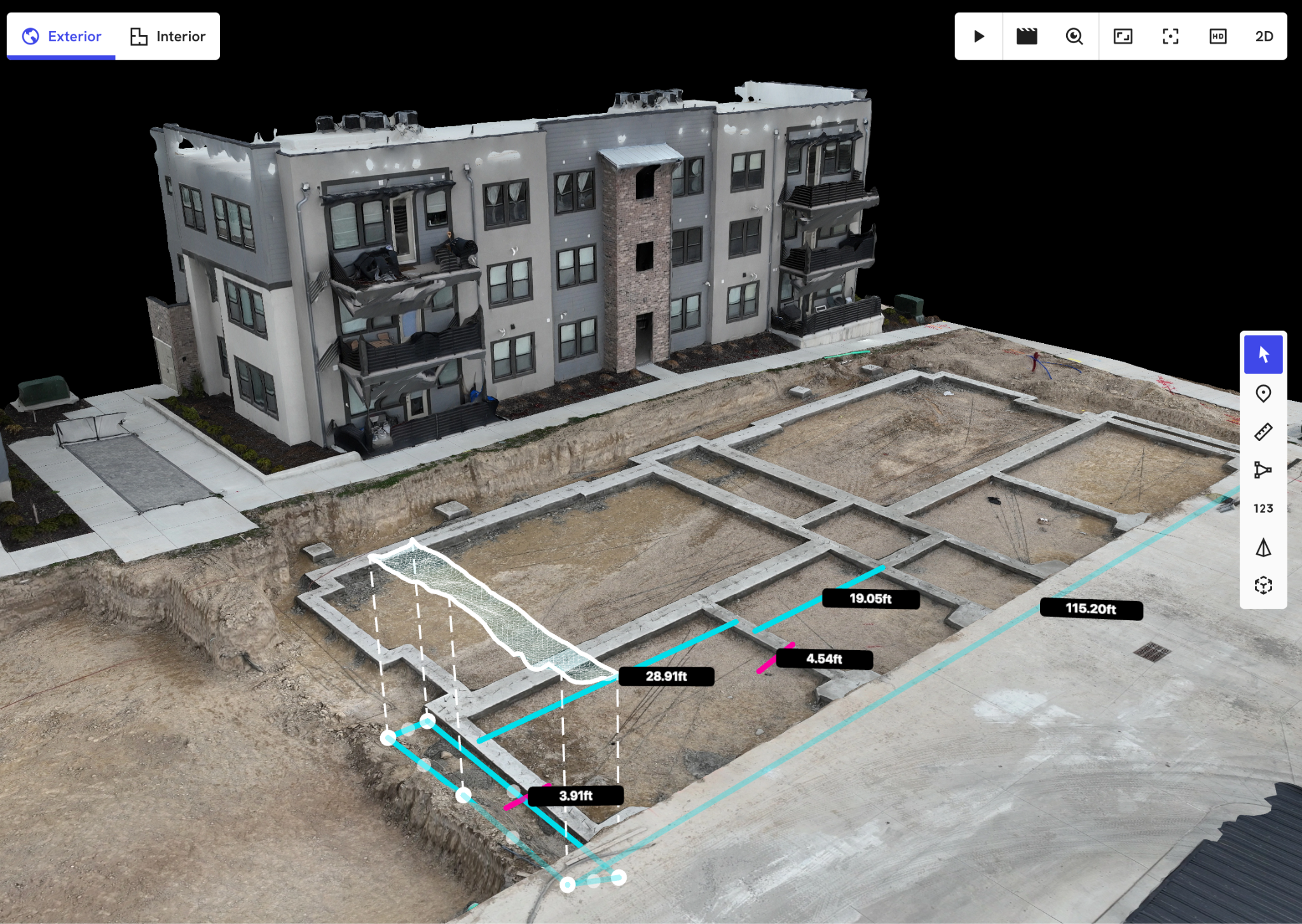
Aerial QA Worx gives builders, developers, and property owners the power to make informed decisions at every stage of the build. Using advanced drone imaging and 3D modeling, we deliver high-impact site intelligence faster and cheaper than traditional surveys.
Services
Serving all of Utah, with availability in other states by request.
3D Elevation Models
and Cut/Fill Estimates
Progress Documentation
Weekly or Bi-Weekly Updates
Exterior Layer Verification
Pay Apps & Insurance Support
Roof & Property Reports
Condition Documentation
Time-Lapse Footage
For Marketing & Updates
Why is Matters
Stop guessing and start building with confidence. Whether you’re prepping raw land or documenting construction progress, our data helps you reduce rework, speed up approvals, and keep everyone aligned.
Ready to see your site from a better angle?
Call or Text us now to book your first aerial inspection and get actionable site data in 48 hours or less.
Ready to get started?
Fill out the form and a member of our team will be in touch shortly to schedule your site flight. Aerial QA Worx is fully insured and operates in full compliance with all FAA regulations.
We look forward to helping you build smarter—from the ground up.